Areas of snow slowly exit; hazardous travel with blowing and drifting
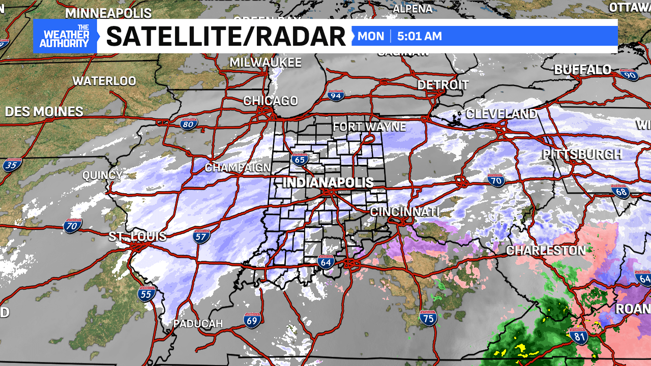
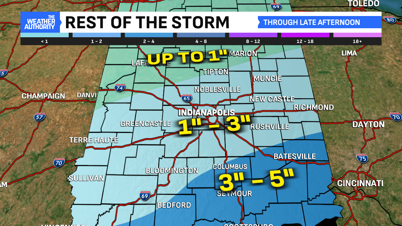
Steady light snow will begin to wind down from northwest to southeast through the early afternoon. An additional 1″ to 3″ of snow is possible with final area of snow now working in from Illinois (5 a.m.). Up to 3″ to 5″ possible in extreme southeastern Indiana closer to the steadier lobe working along the Ohio River. Keep in mind, some of this falling in the southeastern Indiana could bring more of a mixed bag of snow, sleet and ice.
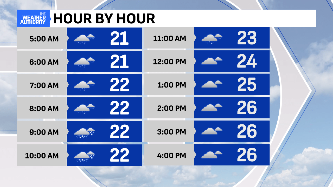
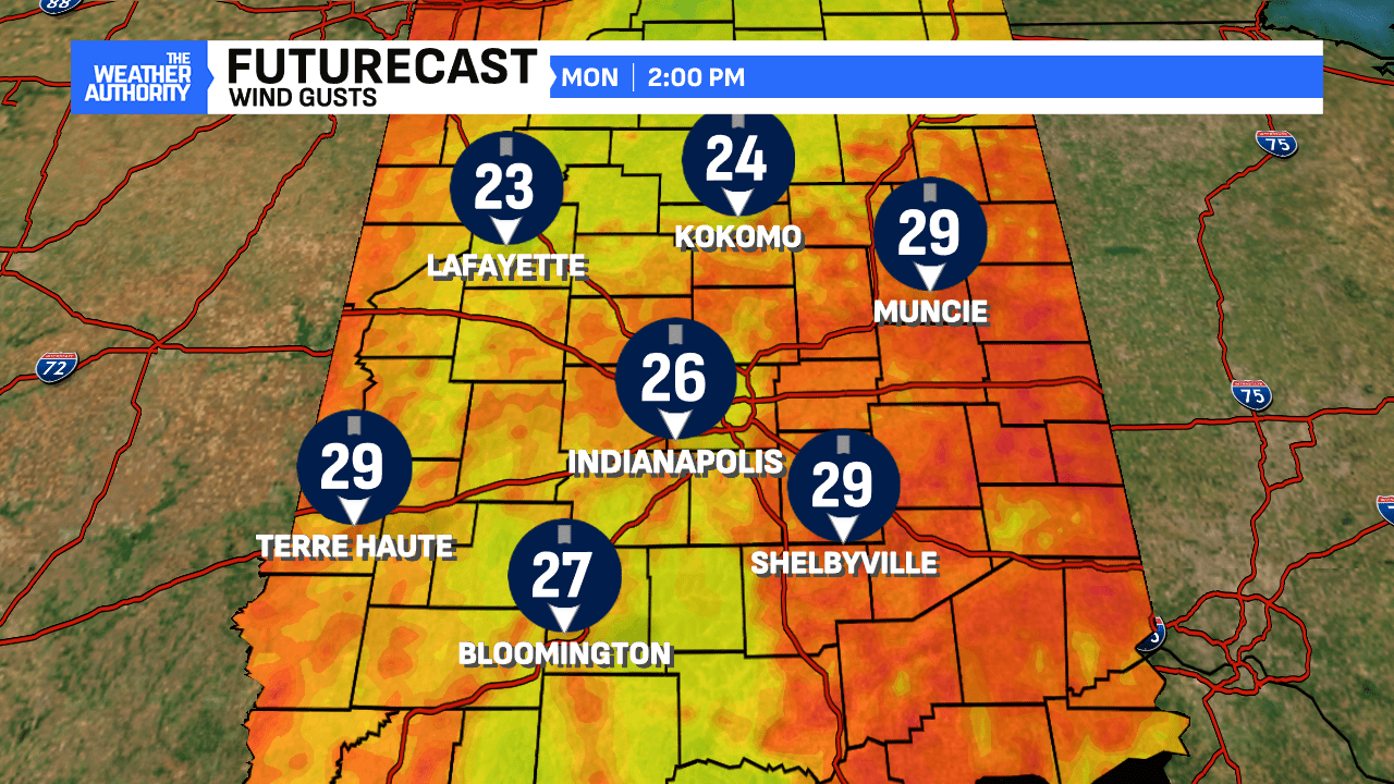
Travel will remain slow to hazardous through the day, as blowing and drifting remains throughout the day! The snow is light and powdery, thus easy to move around with winds gusts up to 30 mph.
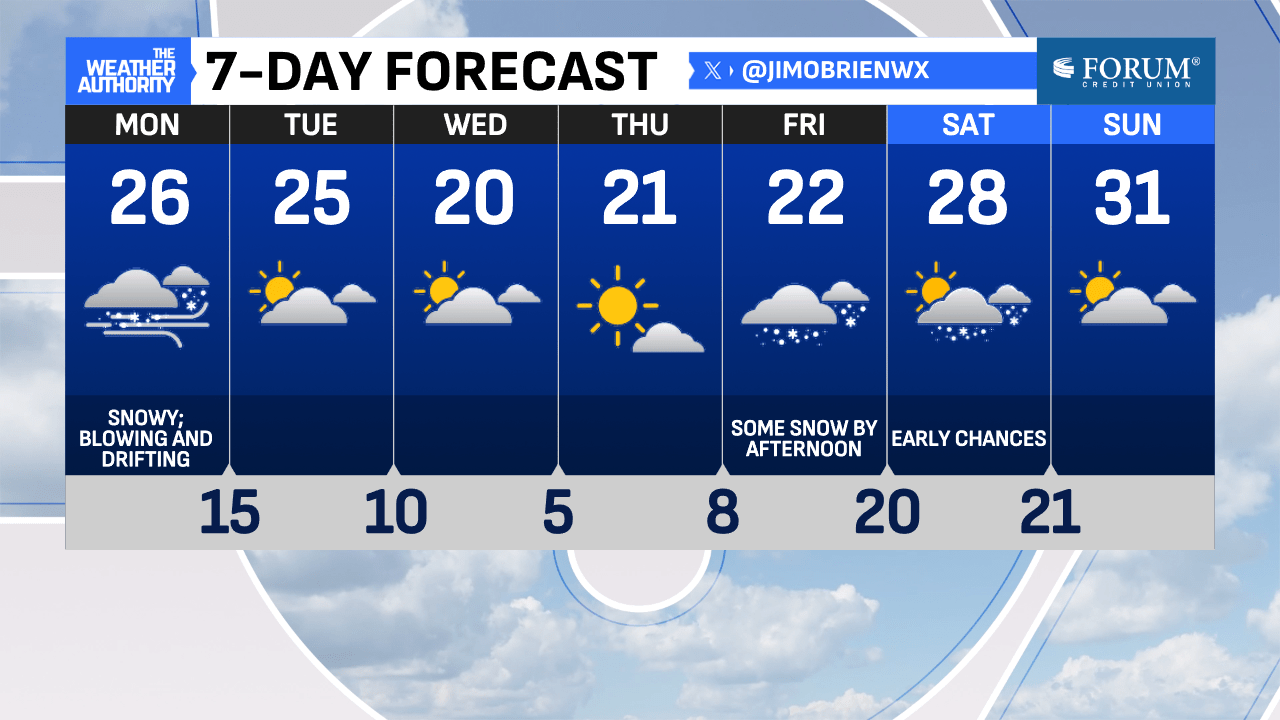
A few flurries and passing lake-effect snow showers will be possible, mainly north tonight with broken clouds, allowing for colder air to drop into the state with lows at 15°.
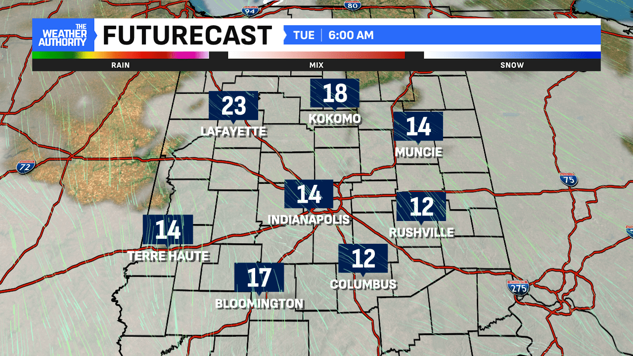
Tuesday through Thursday look dry with highs in the 20s and lows dropping into the single digits in the overnights. Next snow chance arrives on Friday.

Comments are closed.