
Friday: Feeling like early-to-mid June!
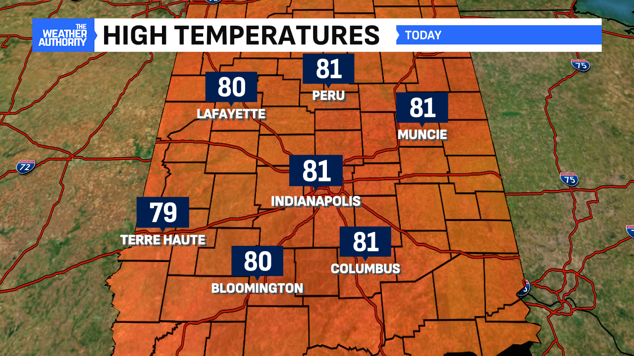
81° is the normal high for June 9-12 in Indianapolis, and we achieved that on Friday! In fact, it was the third such occasion that has happened so far in 2025.
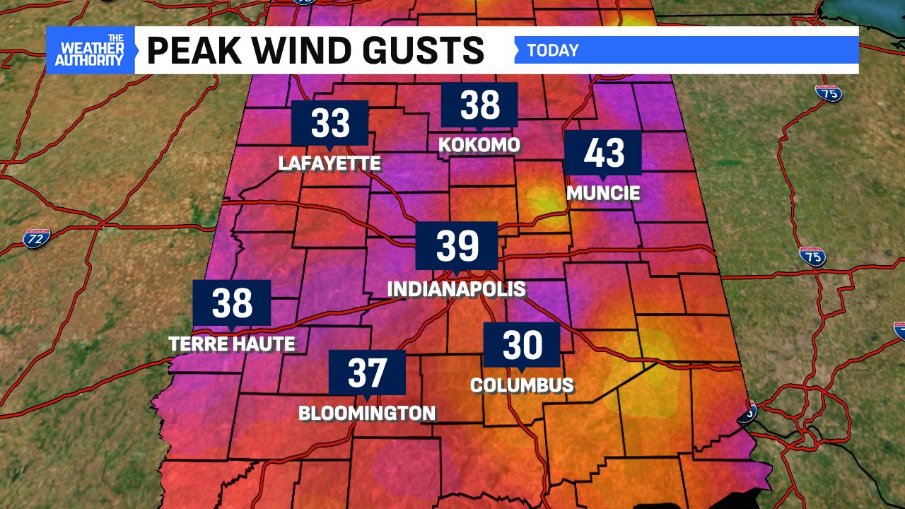
81° also occurred on April 2nd and March 28, making it the warmest temperature for the Circle City so far this year. This was aided by lots of sunshine, a warm front pushing northward and gusty southwest winds bringing in that warmer air. Gusts surpassed 40 mph in spots.
A few sprinkles this evening; main storm threat overnight
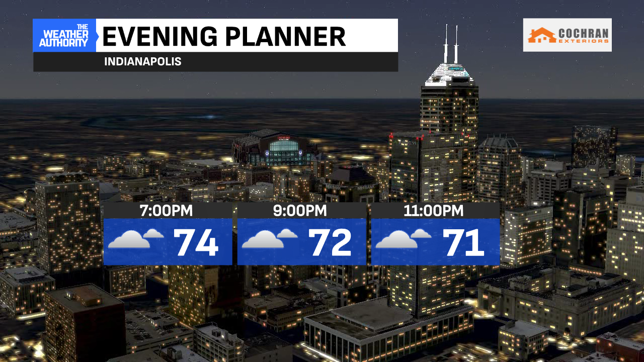
As the main line of the storms gradually forms out west, a few preceding sprinkles are possible this evening. Otherwise, cloudy skies and temperatures in the 70s will be around with the gusty winds Friday evening.
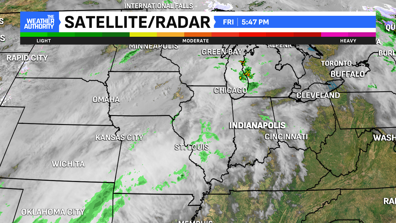
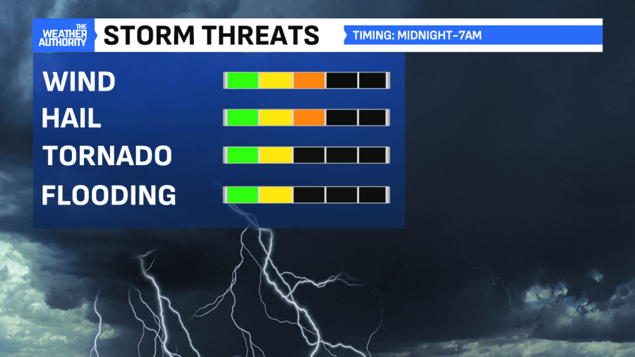
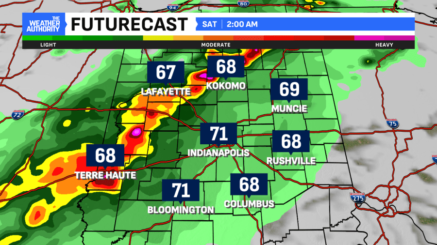
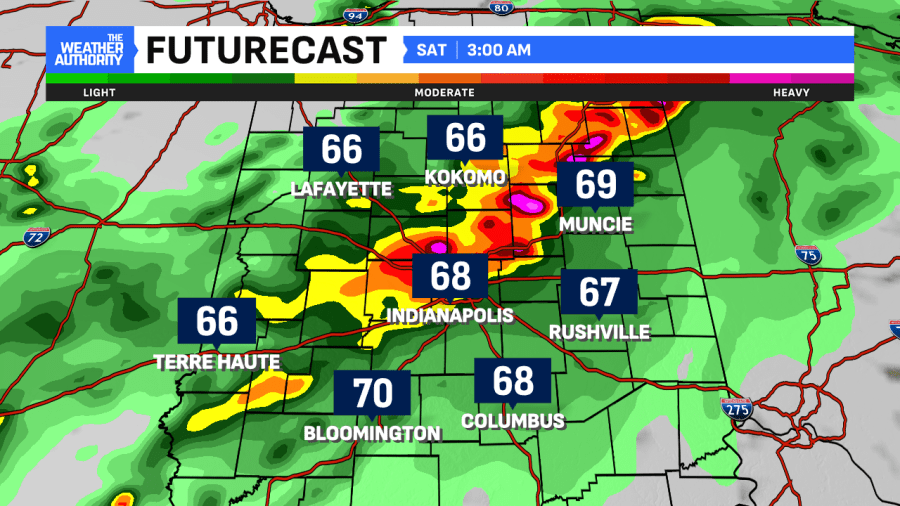
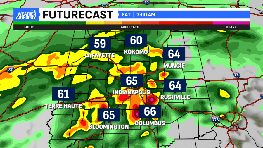
We anticipate storms to move into central Indiana after Midnight and continue through daybreak. The biggest threat will be damaging winds and isolated large hail. Otherwise, some downpours and persistent thunder/lightning is likely. The timing for any storms to turn severe will be 2-3 a.m. and ending mid-morning.
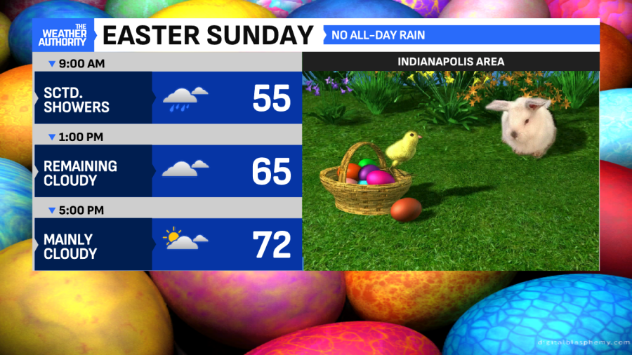
Scattered activity follows with dry hours promised on Easter Sunday
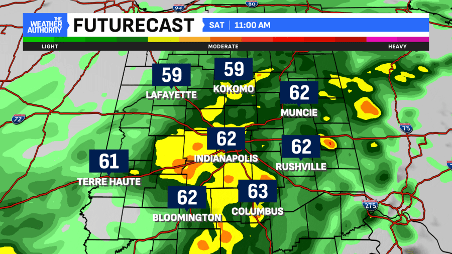
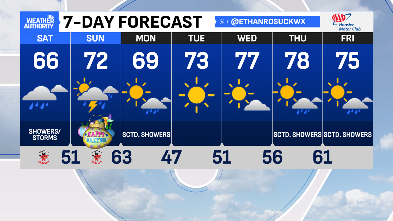
After the main line of storms moves through, the coverage of showers will decrease. But, scattered showers will still be around for most of Saturday but not as heavy compared to the morning activity. Showers will increase in coverage a bit late Saturday into early Easter Sunday. Dry hours will be around during the daytime. If the sun comes out, we could see Easter Highs in the 70s. The next line of storms comes overnight into Monday morning.
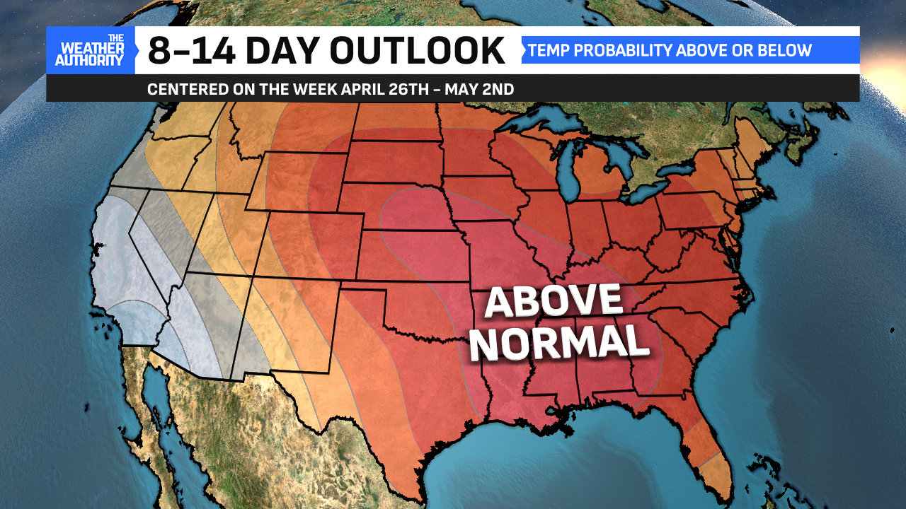
Closing April/Opening May with warmer temperatures
A few rain chances return to the forecast next week. But each day next week, highs will be several degrees above normal. Expect highs in the 70s with perhaps another 80° reading possible. This looks to be the trend for April’s last days heading into May.
Comments are closed.