Polar vortex air on the way; -20° wind chills possible for some
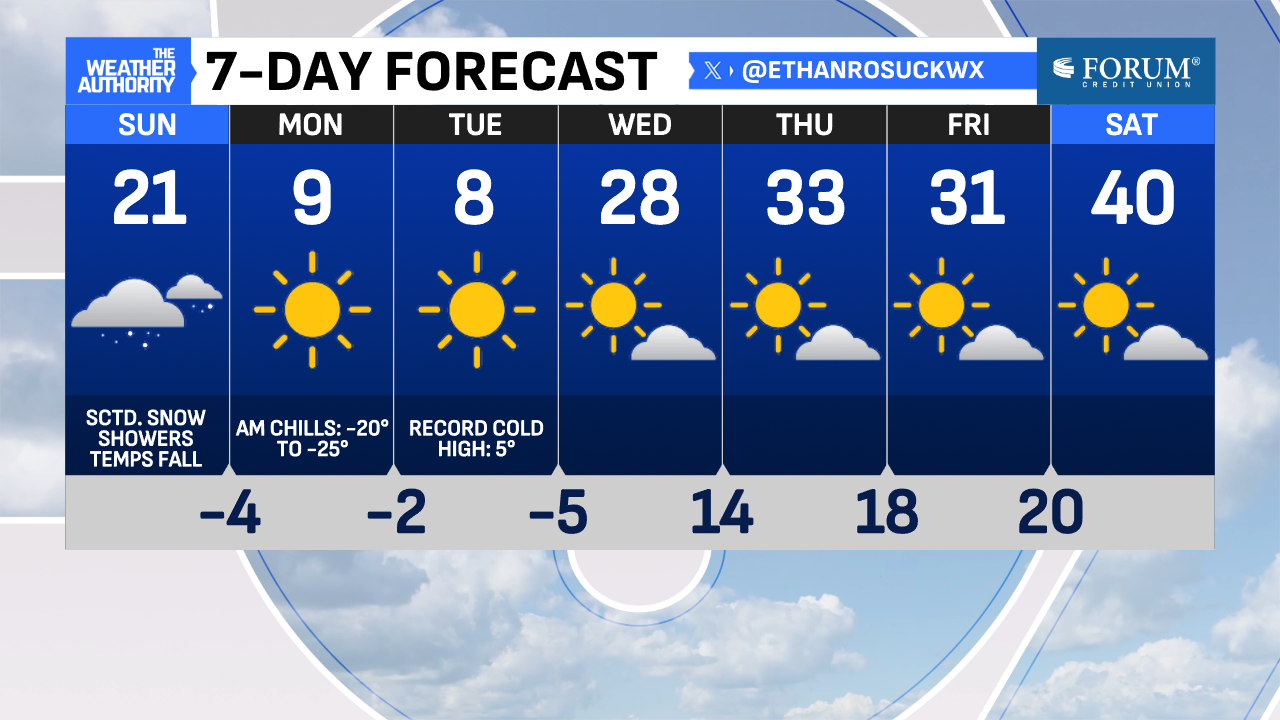
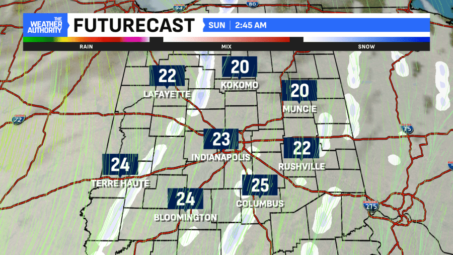
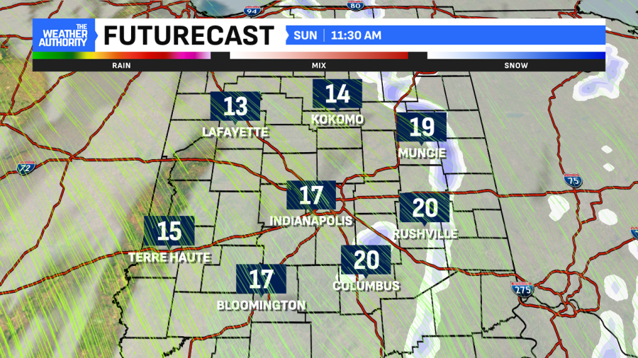
Central Indiana once again had highs around 40° on Saturday. However, this was early, around 12-1 a.m., before a cold front passed through. Temperatures slowly fell with afternoon highs only in the 30s. Another front will sweep through here on Sunday. This will be the one that gives central Indiana its coldest (and most dangerous) air of the season. Behind it, temperatures are in the single digits with double-digit subzero wind chills.
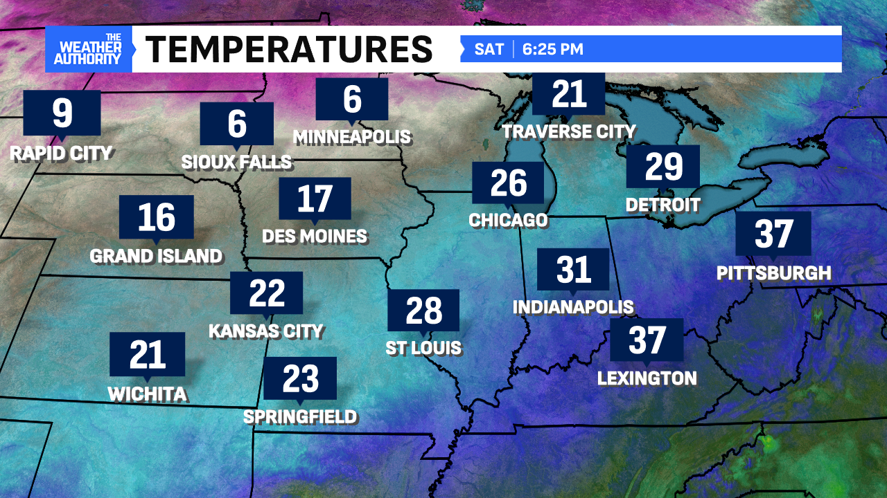
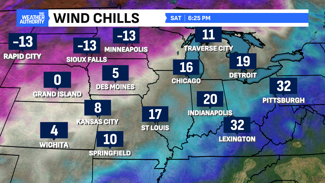
Expect a few flurries/light snow showers to fly overnight and early Sunday. If you can, now is a good time to salt any wet surfaces outside to limit any flash freezes. Highs on Sunday will be around 20°. But, much like Saturday, those will be around Midnight with temperatures plummeting through the day. A quick dusting to half an inch of snow is also possible as the cold front pushes through. This will be our last snow chance for several days.
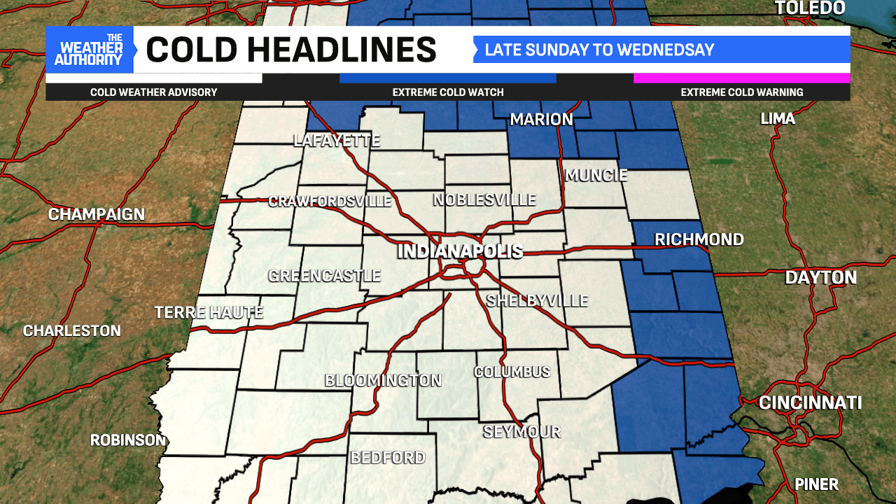
A Cold Weather Advisory will begin Sunday at 7:00 p.m. and be in effect through early Wednesday morning. This was issued because of the polar vortex breaking up to our north and that air flow coming to much of the country. Its effect early this week will be felt nationwide except for south Florida.
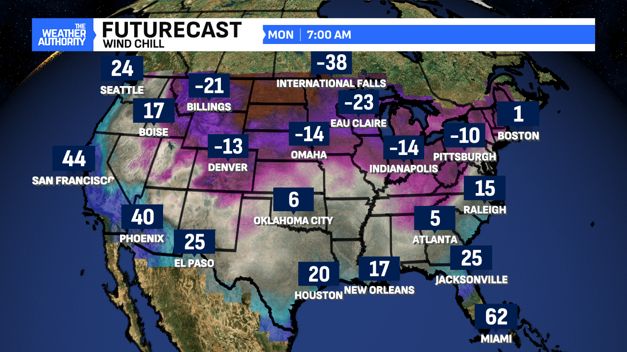
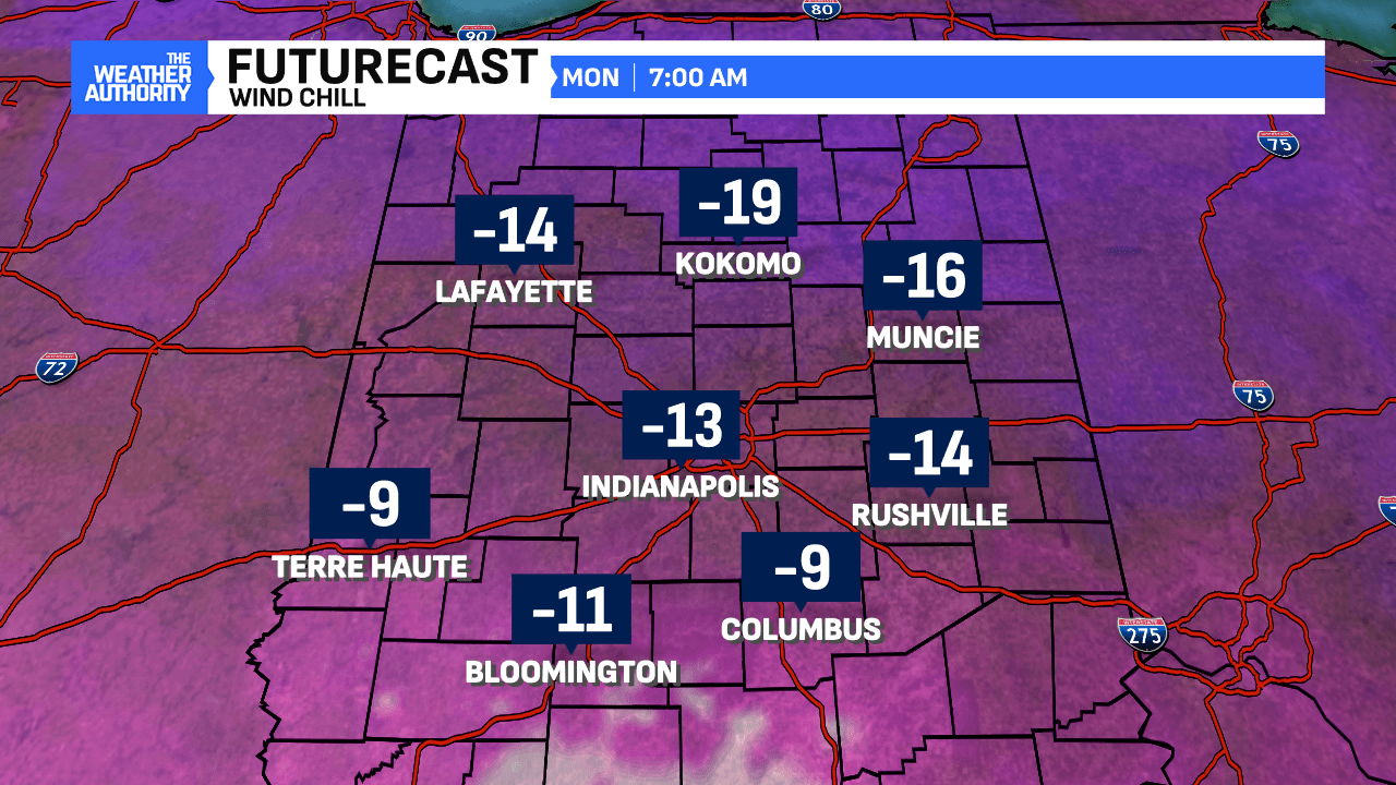
Subzero wind chills return Sunday night and will be at their lowest levels Monday morning. It’s a good thing many schools/workplaces are off for the Dr. Martin Luther King Jr. holiday because the cold will make things tough. Expect wind chills as low as -20 to -25° in spots. The lowest wind chills will be in spots with a deeper snowpack and away from downtown Indianapolis. Similar wind chills will be around Tuesday morning, too.
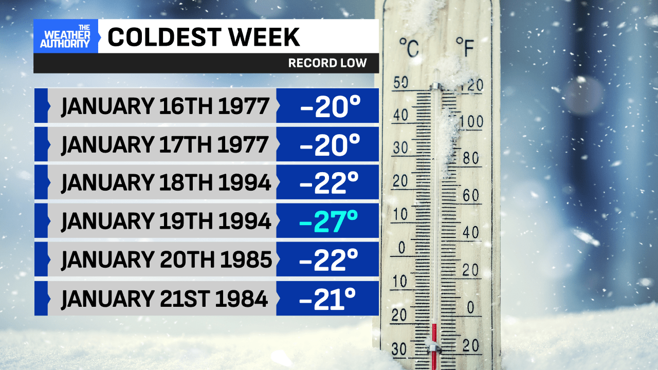
This cold outbreak comes during the historically coldest period of the week for central Indiana. It will be 31 years ago Sunday when Indianapolis recorded its coldest temperature on record (-27°). Additionally, it was that day when the state’s all-time coldest temperature occurred in New Whiteland (-36°).
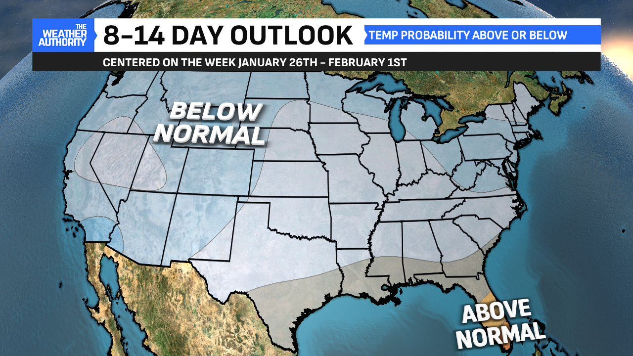
Be sure to stay safe during this cold outbreak. Check out some tips to stay safe here. Luckily, this brutal cold won’t last forever. While the remainder of January does look to have below-normal temperatures, temperatures will moderate back into positive double-digit territory sooner rather than later. Even by next weekend, forecast highs look to surpass freezing. They could approach 40° once again.

Comments are closed.