Quick snow late Thursday; bigger snow potential Sunday
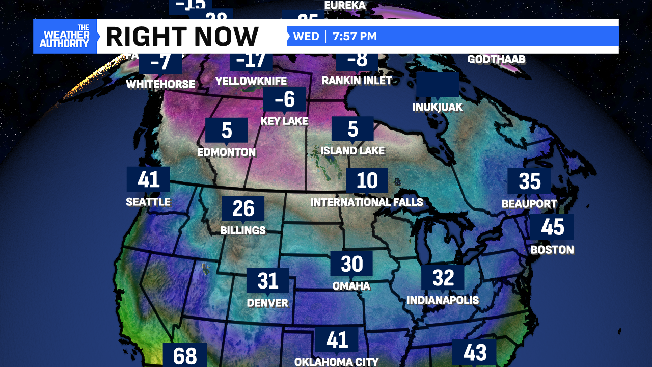
Welcome to 2025! It opened on a seasonable note with highs in the mid-to-upper 30s. A few flurries were also flying as those will exit this evening. After a chilly night, our eyes turn to an Alberta Clipper system for Thursday. This will give us our first snow of the year.
Quick-clipper snow Thursday
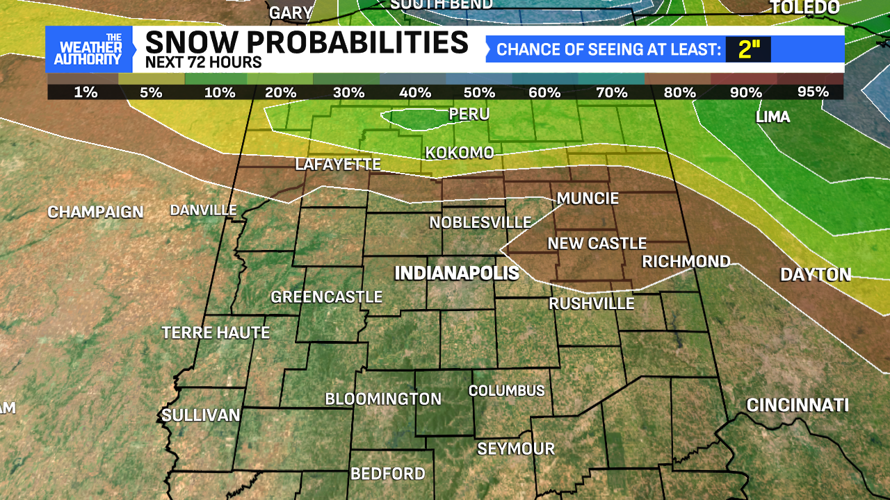
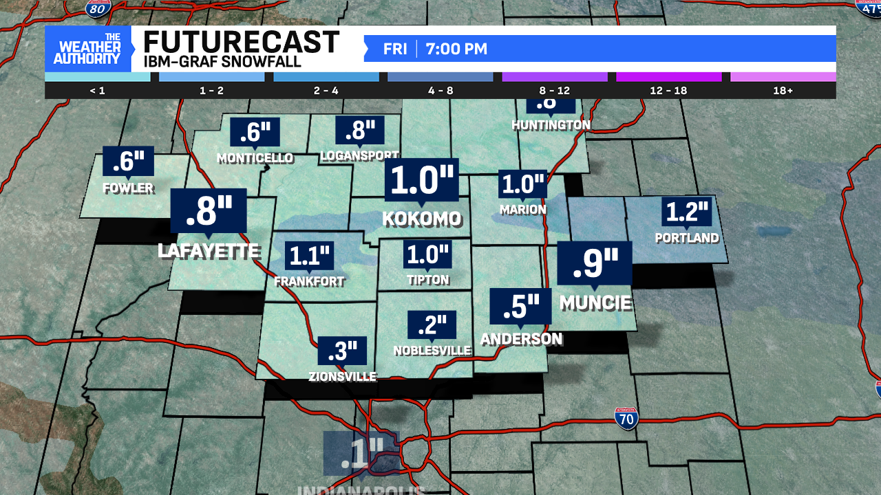
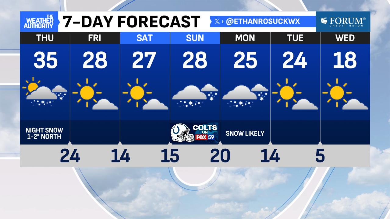
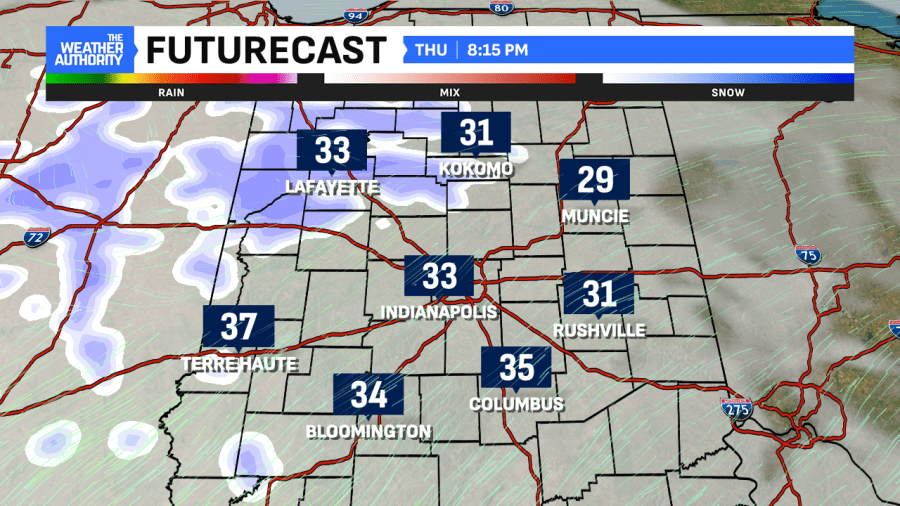
The day starts dry with a few peeks of the sun being possible. Highs Thursday will be very similar to Wednesday all around the mid-30s. Then, this weak clipper system will bring light snow to portions of Central Indiana. Areas north of Indianapolis are favored to see the higher totals. Areas south will see less. Spots north could see 1-1.5″ of snow starting after sunset and continuing to the overnight hours. Spots south could see a trace or none at all.
This event will be a minor nuisance since the snow will have no problems sticking. Heads up if you are heading north Thursday evening through Friday morning.
Next weather maker could bring significant snows Sunday-Monday
After a quiet Friday and Saturday, the potential for a significant snow for the first time this season comes into view. A strong low-pressure system will pass south of Central Indiana in that timeframe. While it’s still too early to mention snowfall totals, it’s looking increasingly likely that some spots (favored Indianapolis and south) will see potentially heavy, accumulating snow. Southern Indiana could even see a mix/ice possibly.
The timing looks to be Sunday afternoon through Monday but some snow onset could start around daybreak Sunday. Storm track is key and now that the system is entering land, we’ll be able to monitor its behavior over the next several days. This is not the best timing due to holiday breaks ending and work/school resuming Monday.
Below is the latest run of the European model showing what could happen Sunday. We will get more specific in the days ahead. Stay up to date!
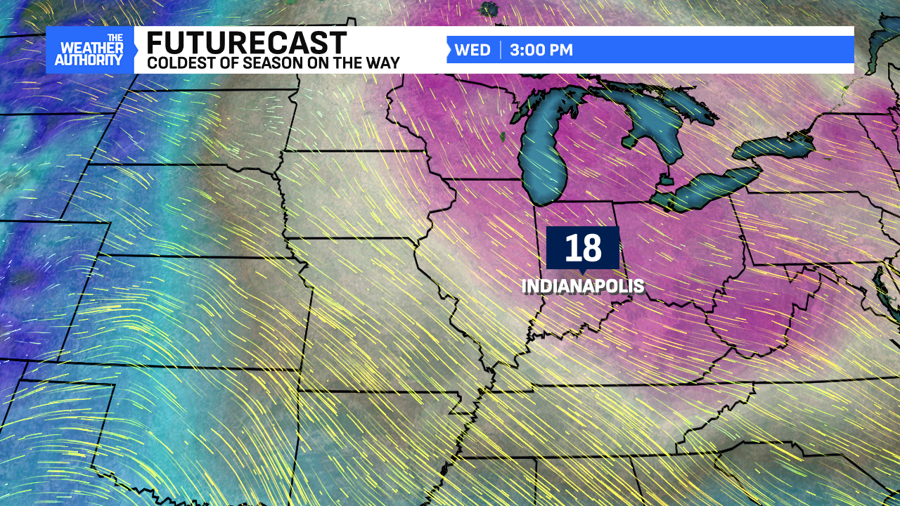
Coldest air of the season follows next week
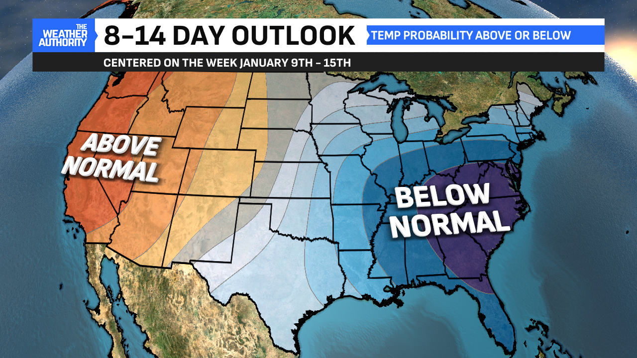
Any snow that falls won’t be leaving the grounds anytime after that. This is because an Arctic airmass will drive a taste of the polar vortex down into the United States about a week from now. Highs will be in the teens with lows in the single digits/below zero. We’ll have this pattern likely heading into mid-January with below-normal temperatures very much in play.



Comments are closed.