
Round #1 Moving In As Scheduled
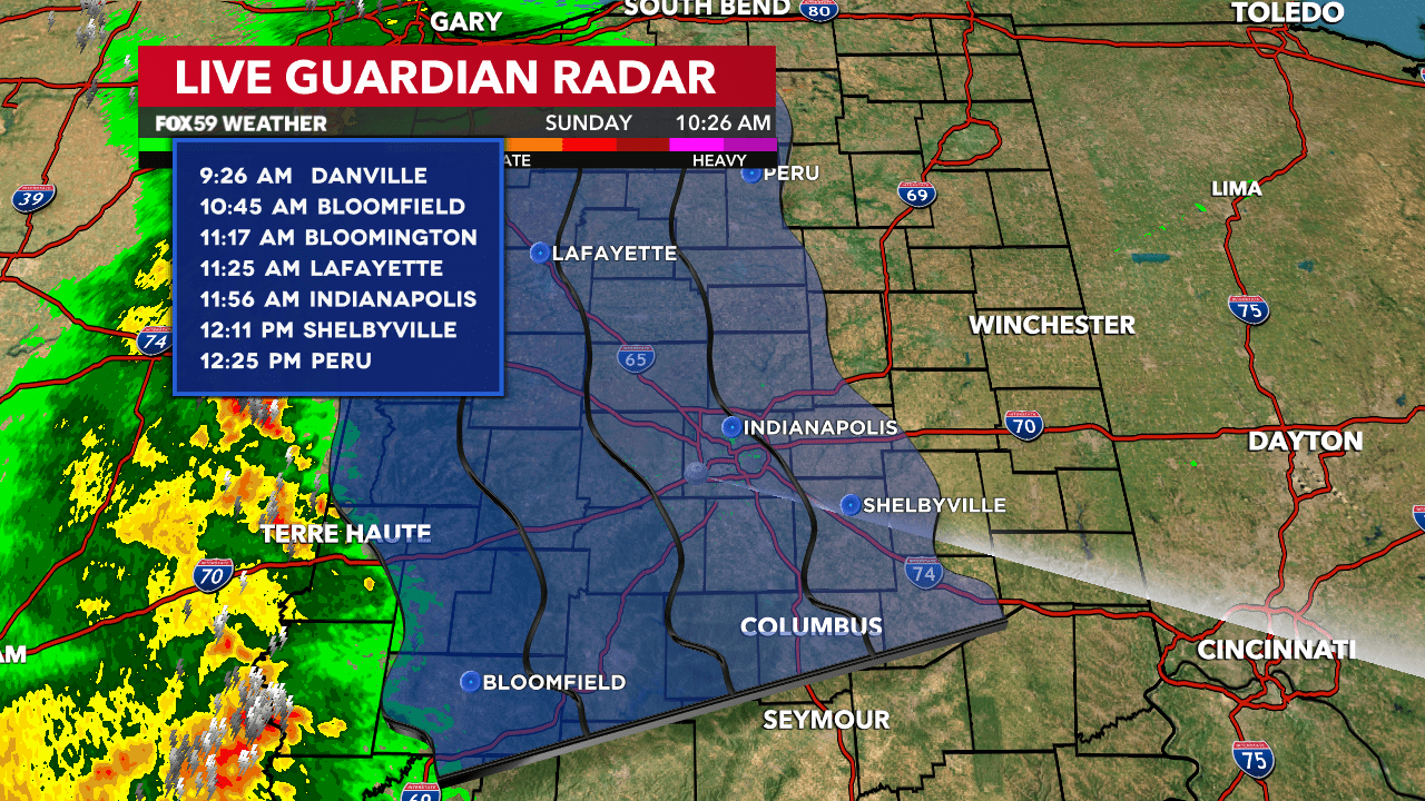
Just as forecast, the first round of rain is moving into Central Indiana as of this writing. Not the best news for the scheduled start time of 12:45 p.m. for the Indy 500. Fans are exiting the track and all pre-race celebrations have stopped. The track does have procedures in place for storm activity.
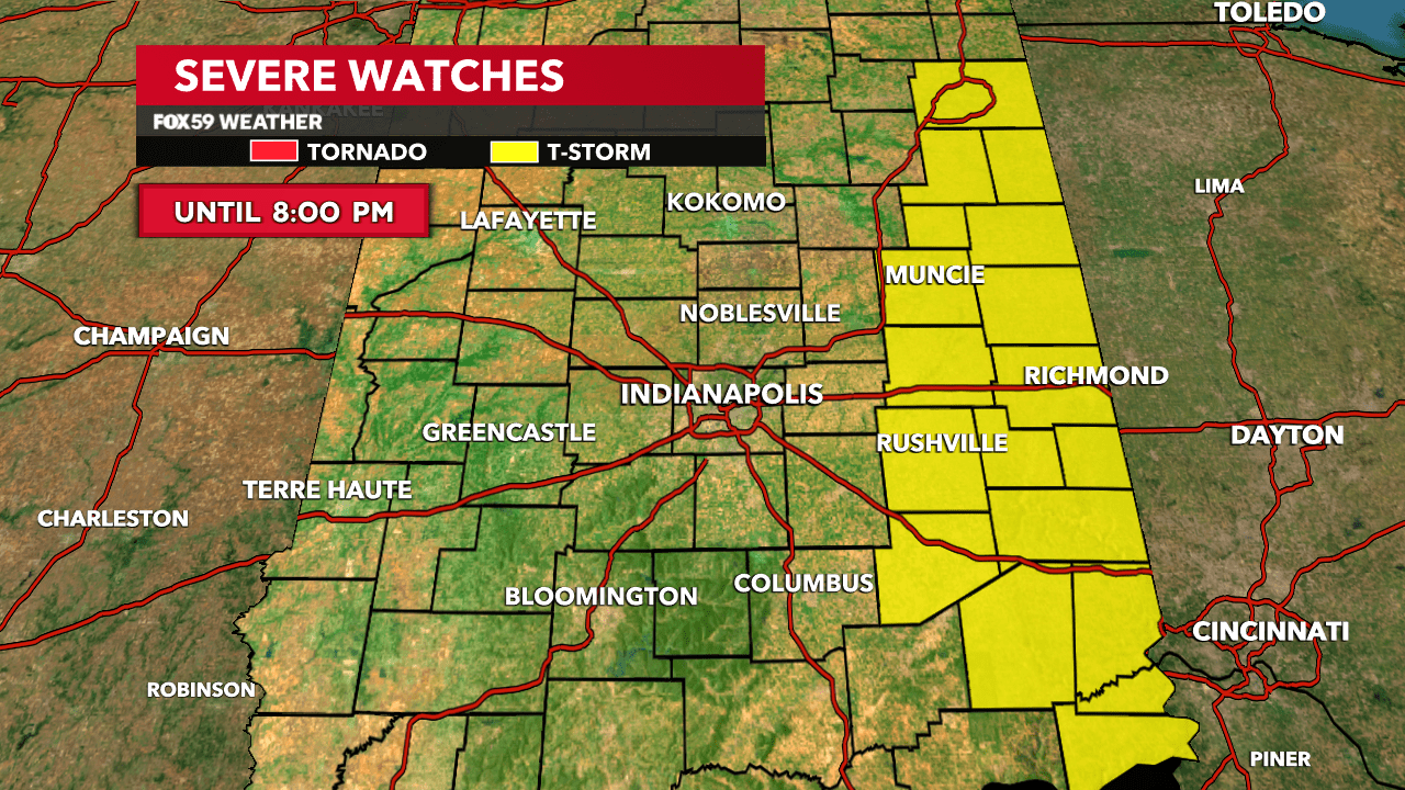
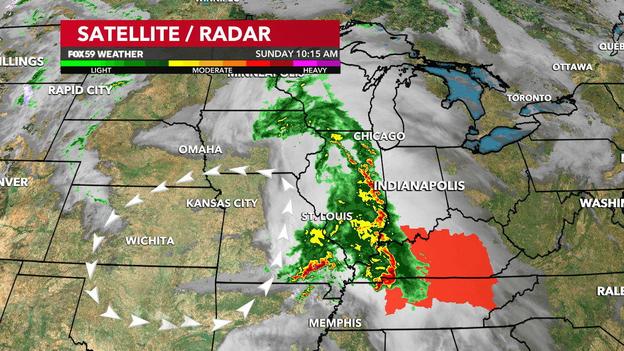
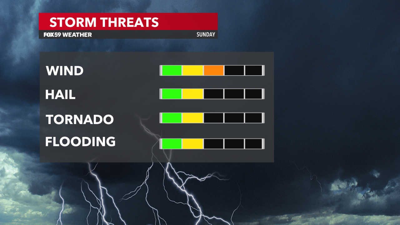
This initial line of storms will likely reach Indy Metro and the Indianapolis Motor Speedway between 12-1 p.m. Gusty winds, lightning & locally heavy rain are the main threats. The line is moving NE at 35 MPH. A few Severe T-Storn Warnings have been issued so far with a Severe T-Storm Watch in effect for our SE/Eastern Counties until 8:00 p.m. This is for gusty winds with the line advancing NE. See the graphic below.
Remember, “When thunder roars, go indoors!” This will be the story for folks at IMS.
Expect a couple of hours of rain with this line of storms. For the most part, these storms will be below severe limits. But stay weather-aware!
Break to likely follow
Over the last week, IMS officials have been planning for rain potential. With that in mind, they have implemented measures to dry the track so the race can get in after the rain finishes. The potential for a “window of opportunity” is still in play as there is clearing behind this line.
Expect temperatures and humidity levels to go up later this afternoon. With this in mind, thiswill attempt to set the stage for round #2 of storms Sunday evening. This could bring another severe threat to Central Indiana likely after the race.
Round #2 Sunday evening
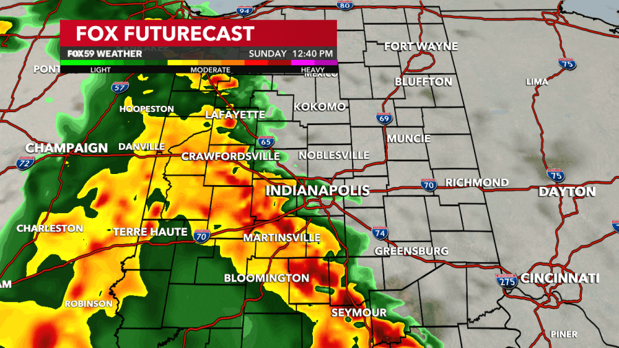
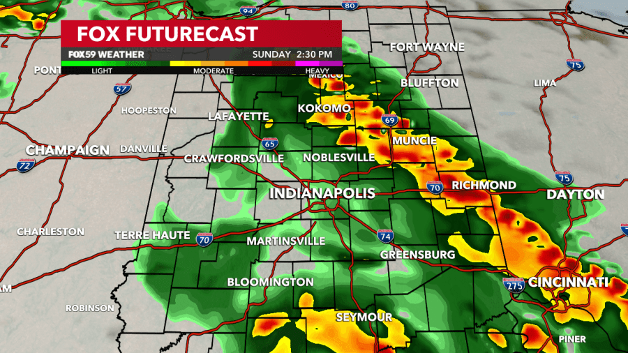
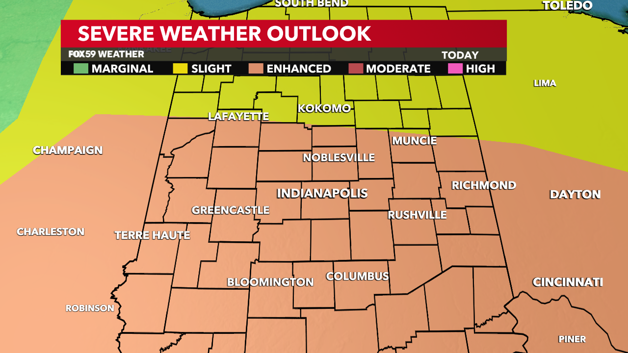
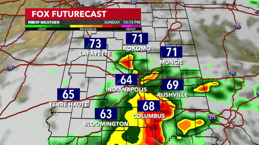
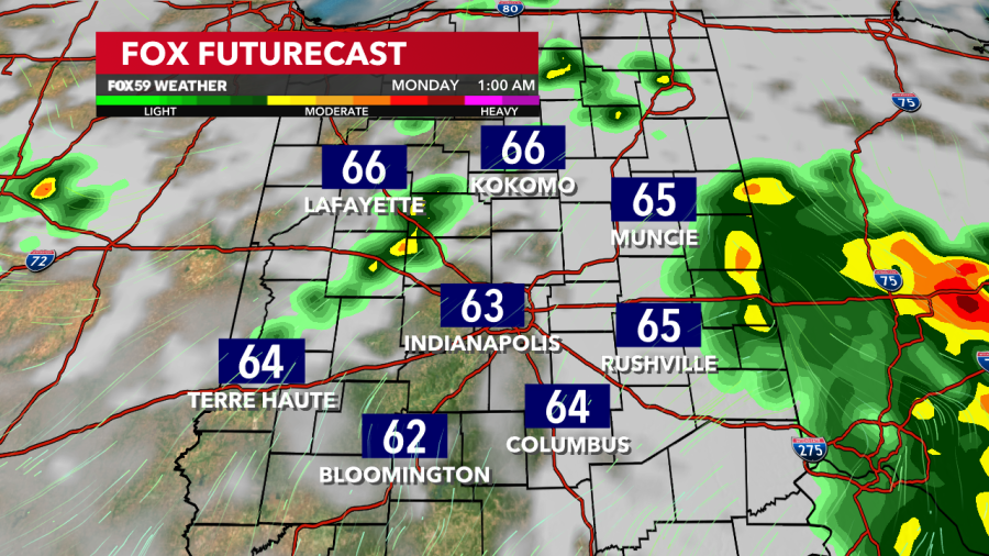
With afternoon clearing, temperatures will go up along with humidity levels. Along with increasing winds, all of these will serve as “fuel” for evening storm development. The Storm Prediction Center has most of Central Indiana under an Enhanced Risk (level 3 of 5) for severe weather. Damaging winds remain the biggest threat but all modes of severe weather are possible.
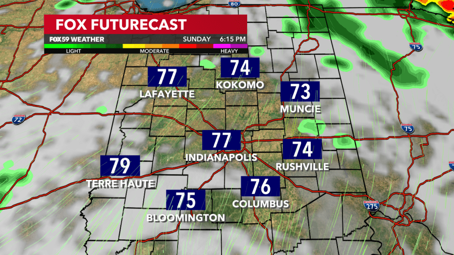
How this round plays out will depend on how quickly the first round moves out and how much clearing we see. At this time, areas just south and west of Indianapolis have a slight uptick in severe potential should these storms develop. This will all come ahead of a cold front. See the Futurecast imagery below.
Comments are closed.