
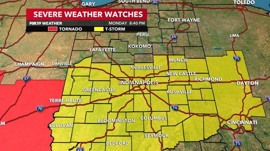
INDIANAPOLIS — A severe thunderstorm watch has been issued until 3 a.m. for Marion County and the majority of central and parts of south central Indiana as the threat of severe weather looms.
The National Weather Service announced that a severe thunderstorm watch has been issued in the following counties:
Bartholomew, Boone, Brown, Clay, Daviess, Dearborn, Decatur, Delaware, Fayette, Fountain, Franklin, Greene, Hamilton, Hancock, Henry, Jackson, Jennings, Johnson, Knox, Lawrence, Madison, Marion, Martin, Monroe, Montgomery, Morgan, Owen, Parke, Putnam, Randolph, Ripley, Rush, Shelby, Sullivan, Union, Vermillion, Vigo and Wayne.
Meanwhile, NWS announced that Hendricks County is under a severe thunderstorm warning until 10:15 p.m.
According to previous reports, there is a risk of damaging winds, large hail and flash floods throughout central and southern Indiana. Reports indicate isolated tornadoes could develop. The storms will increase in coverage and intensity before 12 a.m.
Comments are closed.