Winter storm warning in effect for central Indiana Sunday and Monday
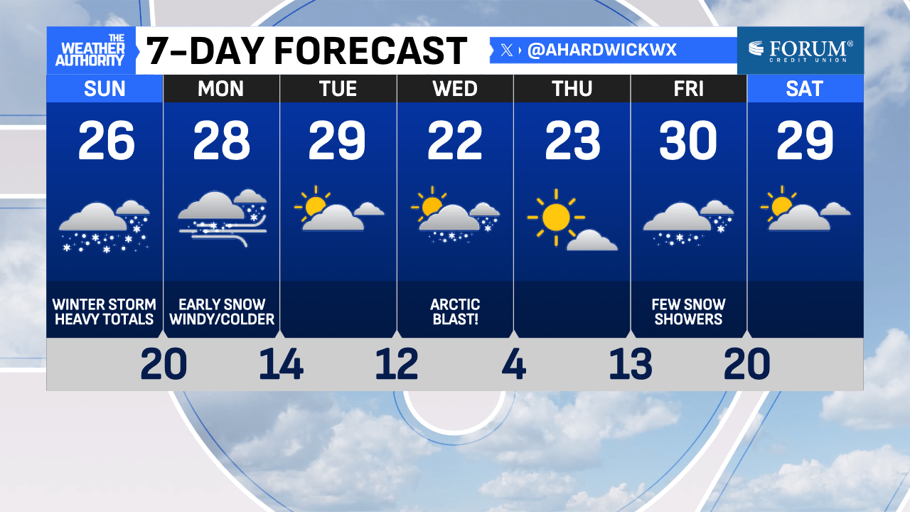
Snow has already arrived in Indiana this Sunday morning. The coverage early in the day is going to be more scattered but will increase considerably this afternoon. Most of central Indiana is highlighted under a Winter Storm Warning for today with a Winter Weather Advisory issued in our northernmost counties.
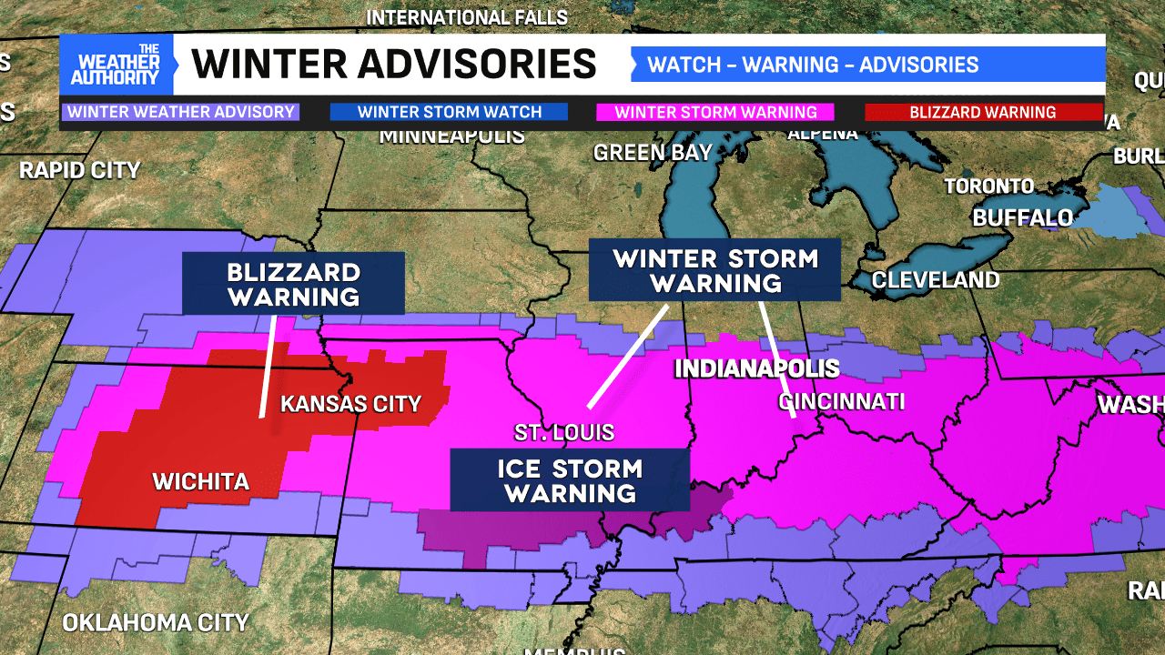
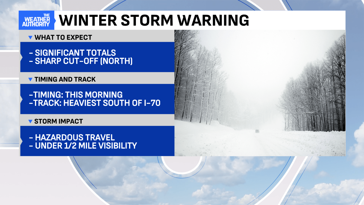
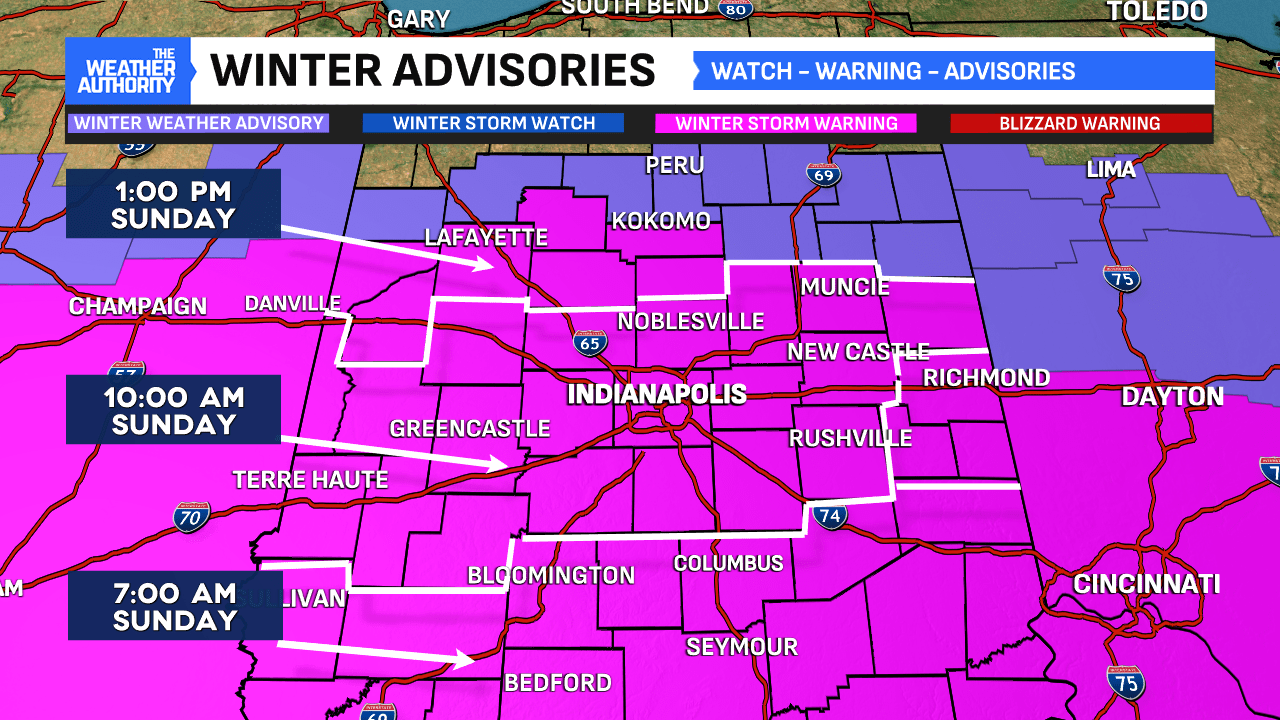
- Winter Storm Warning for southern Indiana officially started at 7 AM and will remain in effect through 7 PM Monday.
- Winter Storm Warning for most of central Indiana, which includes Indianapolis, Muncie, and Greencastle, begins at 10 AM and will expire at 7 PM Monday.
- More counties were upgraded to a Winter Storm Warning north of Indy earlier this morning. The warning area now includes Lafayette and Kokomo. The warning is set to begin at 1 PM with the later arrival time for snowfall.
- A Winter Weather Advisory for White, Cass, Miami and Grant counties also starts at 1 PM and will expire 7 PM Monday.
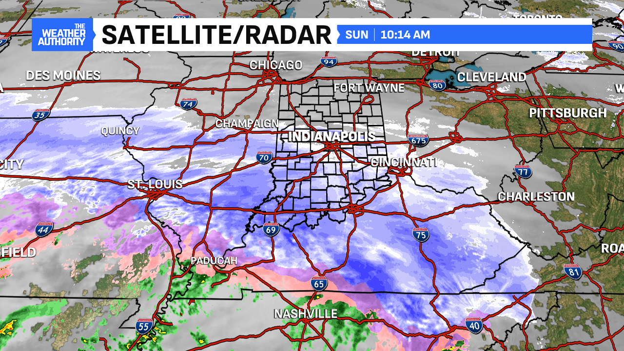
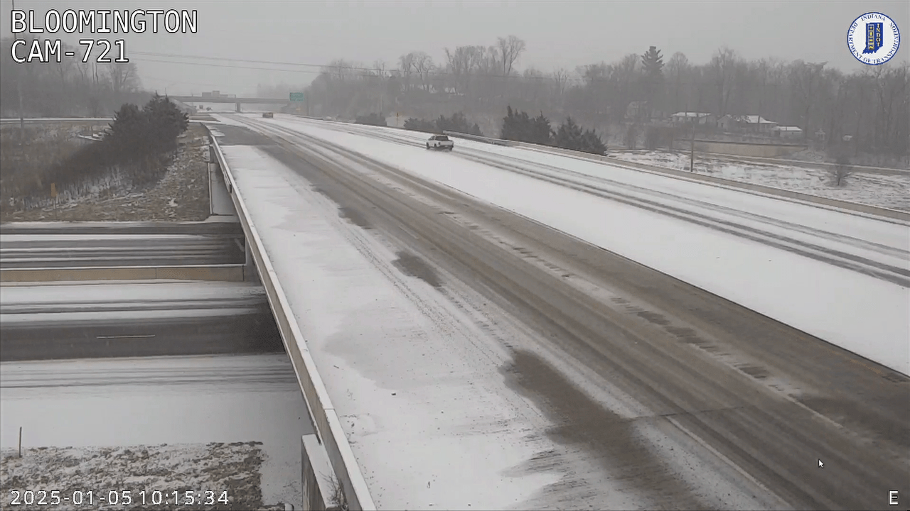
Snow was already sticking to area roadways and grass within Monroe County at 9:30 AM Sunday. This is just the beginning of an active 24 to 48 hours within central Indiana. The snowfall coverage is going to ramp up this afternoon and heading into the evening hours. This means travel may be difficult for those attending and heading home from the Colts game this afternoon.
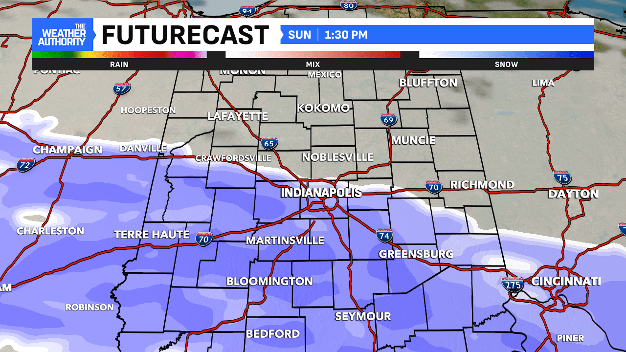
The snowfall rates start intensifying after 3 PM and will continue into the evening throughout the region. Note this evening, a pocket of warm air aloft may nudge into south central Indiana, which may contribute to the formation of sleet. Because of the nearby warm pocket, the snowfall we initially see will likely be more of a heavy, wet snow from this system.
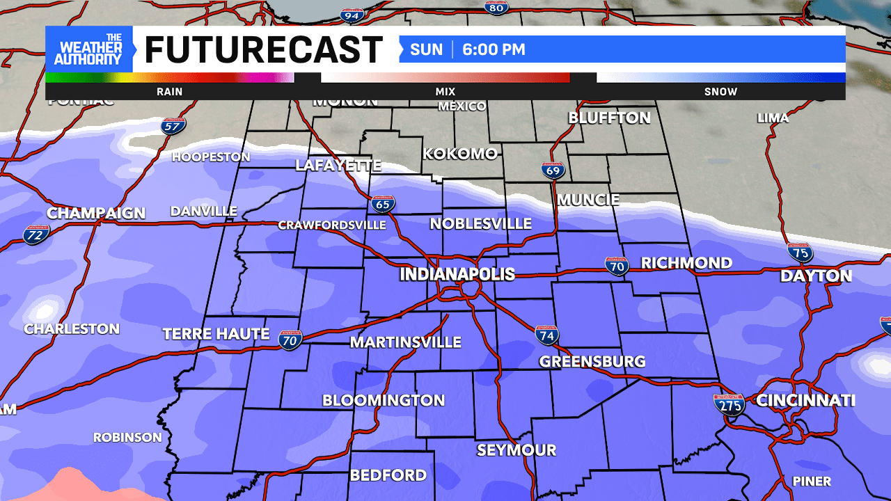
Futurecast shows a chance for sleet locations south of downtown Indianapolis between 6 PM SUN and 12 AM MON. Patchy freezing drizzle may also develop early in the overnight. If sleet does mix in with snow, there is a risk for snowfall totals to sharply cut-off where forecast models are indicating higher amounts. For that, we will have to wait and see what conditions develop later this evening.
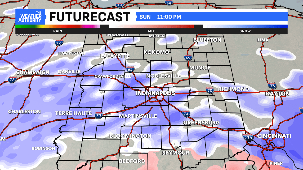
Steady snowfall rates re-emerge overnight as another wave or “pulse” tracks across the region. The next round reinforces the colder, drier air mass building behind the system. This will in turn result in a lighter, powdery snow versus the heavier, wet snow. Wind speeds will rise overnight with the potential for gusts up to 35 MPH. Blowing and drifting snow cannot be ruled out overnight and early Monday.
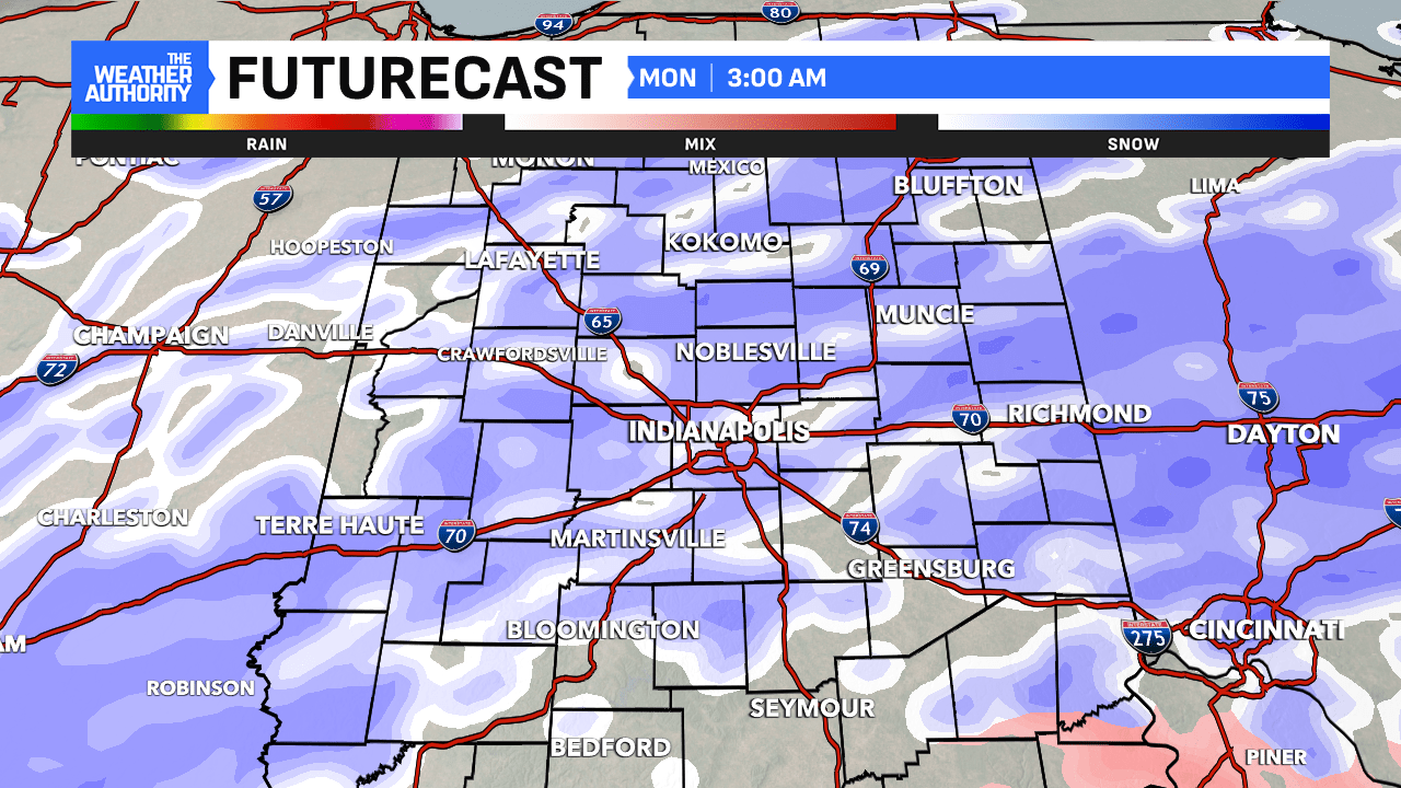
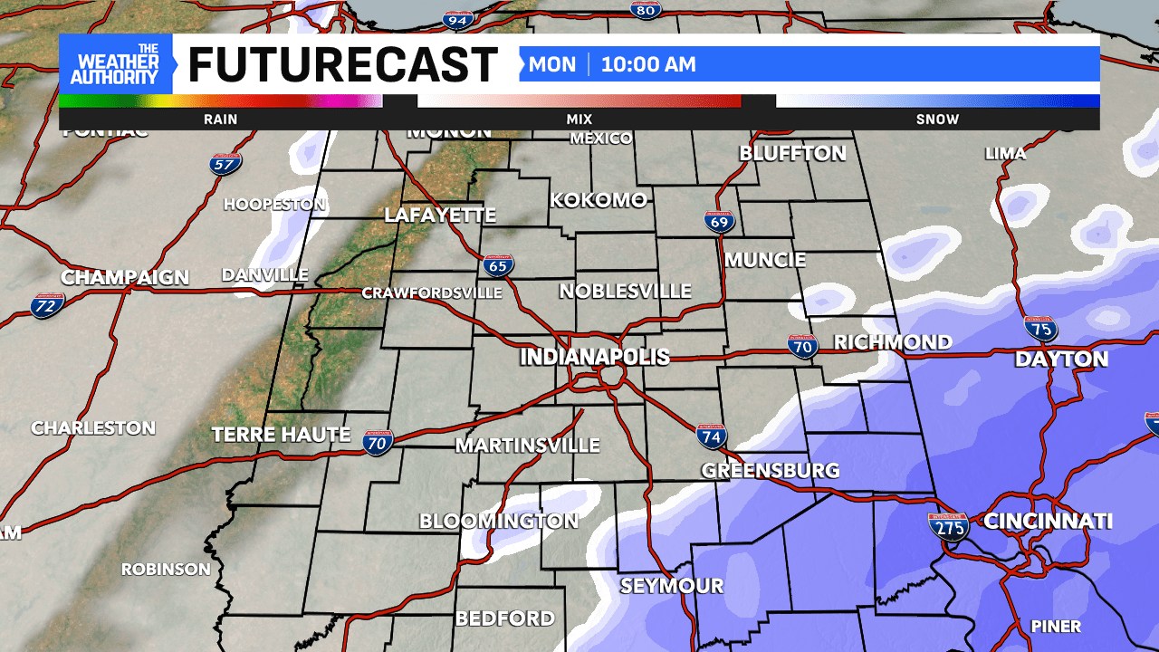
Snowfall will continue into Monday morning, which will likely create hazardous travel conditions for the morning rush hour. You should be prepared for slow, difficult travel if you must be on the roads during the event. The snowfall should begin to taper off midday and completely exit late Monday afternoon.
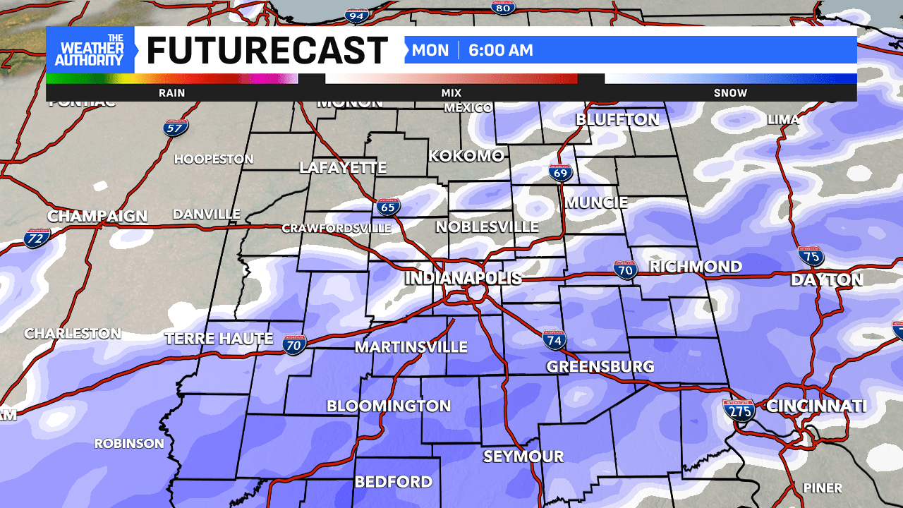
Significant snowfall totals are still anticipated from this winter storm. Near Indianapolis and for a large portion of the area, totals may range between 6″ and 10″. However, there is a zone located south of I-70 that has a shot at seeing double digit totals by the time the event wraps up Monday evening. Local amounts from 10″ to 12″ are possible within the highlighted area, including Bloomington, Columbus and Batesville. As stated above, if sleet makes its way into south-central Indiana, snow accumulation totals will be affected, and those spots may see less snow than anticipated. Stay tuned for updates.
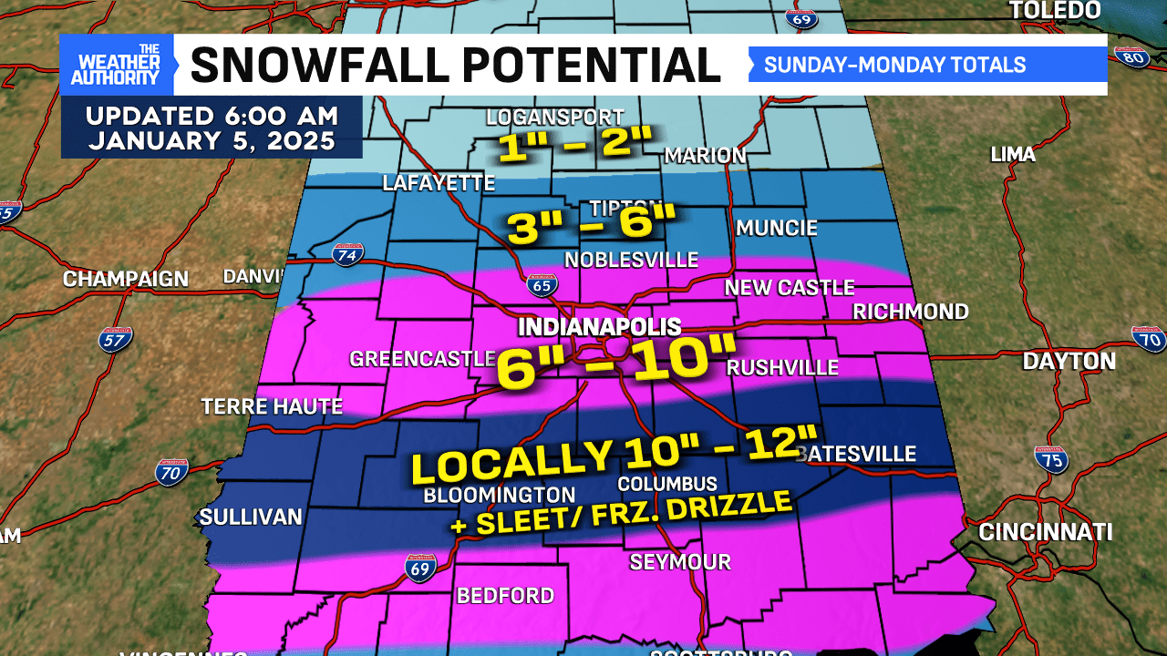
There is going to be a sharp cut-off of snowfall amounts to the north. For now, 3″ to 6″ of snow is possible north of Indy with lighter totals expected in the counties under a Winter Weather Advisory. Keep in mind, even with less snow to the north, travel across the viewing area is going to be difficult as the winter storm tracks across the state.

Comments are closed.