
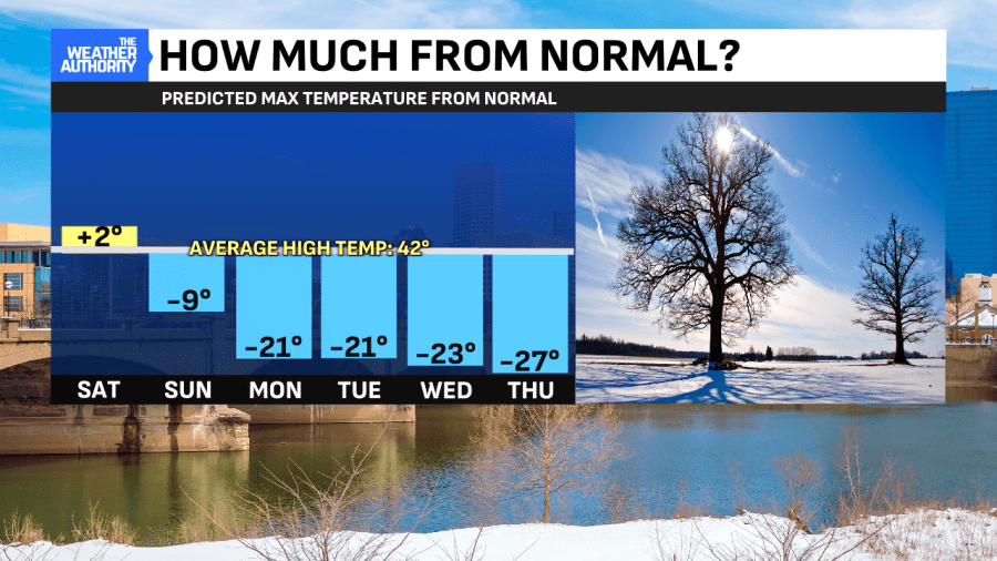
Coldest morning in three weeks behind us
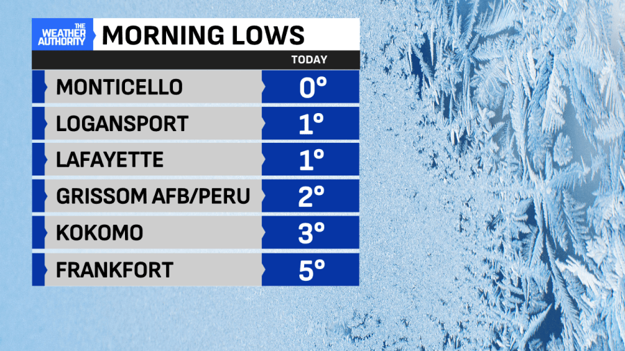
INDIANAPOLIS — Valentine’s Day started on a chilly note, with the coldest lows in more than three weeks. Several of our hometowns north and northwest of Indianapolis achieved single-digit lows. Monticello (White County) got down to 0° with Logansport and Lafayette down to 1°. Indianapolis achieved a low of 10°. Lows like this will be the new normal next week when another Arctic blast moves in. Until then, we have a sloppy mess to deal with.
Snow showers precede Winter Weather Advisory/wintry mix
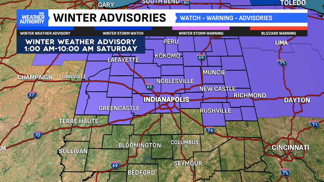
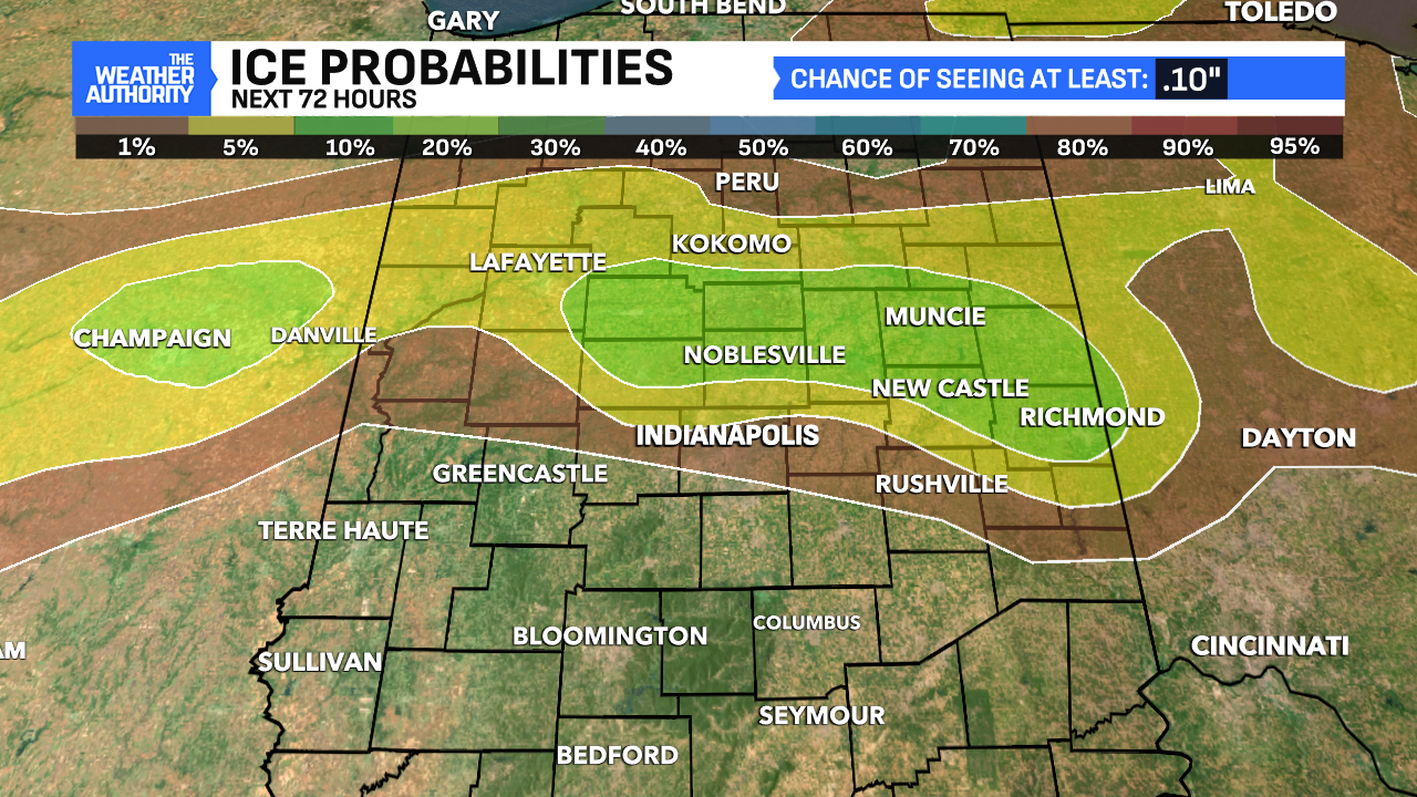
A period of light snow showers will move through Central Indiana this evening before Midnight. Not a lot of snow will come from this, perhaps a quick coating in spots. This will precede the Winter Weather Advisory that kicks in at 1 a.m. for the wintry mix on tap along and north of I-70.
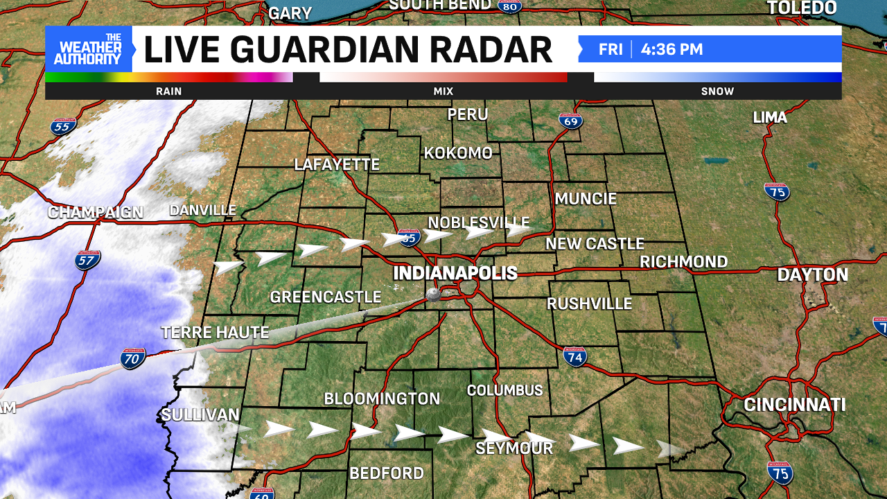
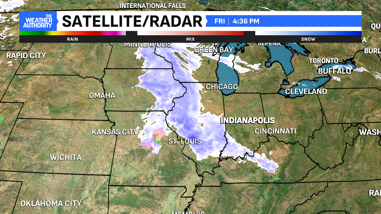
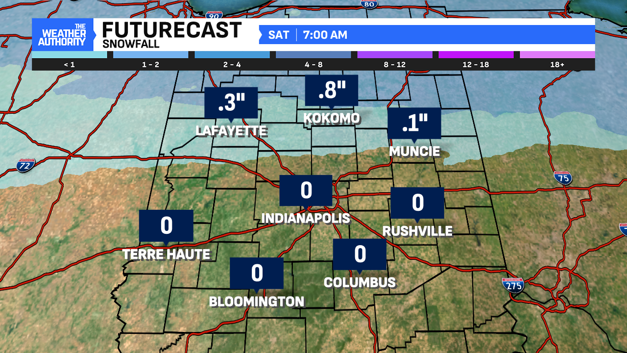
Starting after midnight and going through Saturday morning, the next round of precipitation moves in. A combination of snow, sleet/freezing rain and rain moves in. For spots along and north of I-70, there could be a light icing, especially on elevated and untreated surfaces all before daybreak Saturday. Additionally, our far northern counties could receive a quick half an inch to an inch of snow. Be aware if you’ll be out early Saturday, this is the first wave of precipitation that will move through.


Lull/break midday Saturday
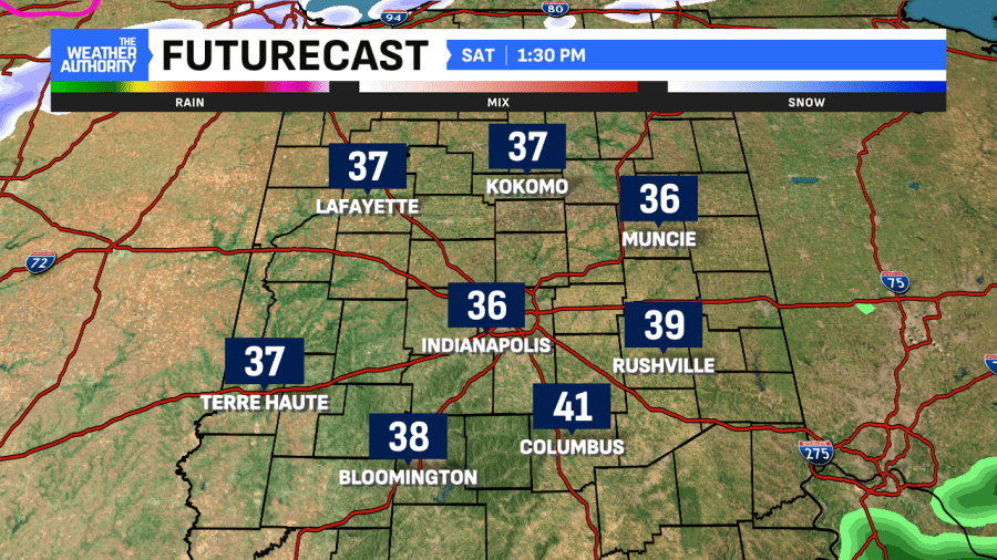
Dry hours are promised for the middle portion of Saturday. In fact, during that time, highs will approach 40°. This will be the warmest forecast high for at least the next week across central Indiana. This will come before the next round of precipitation arrives Saturday evening into Sunday.
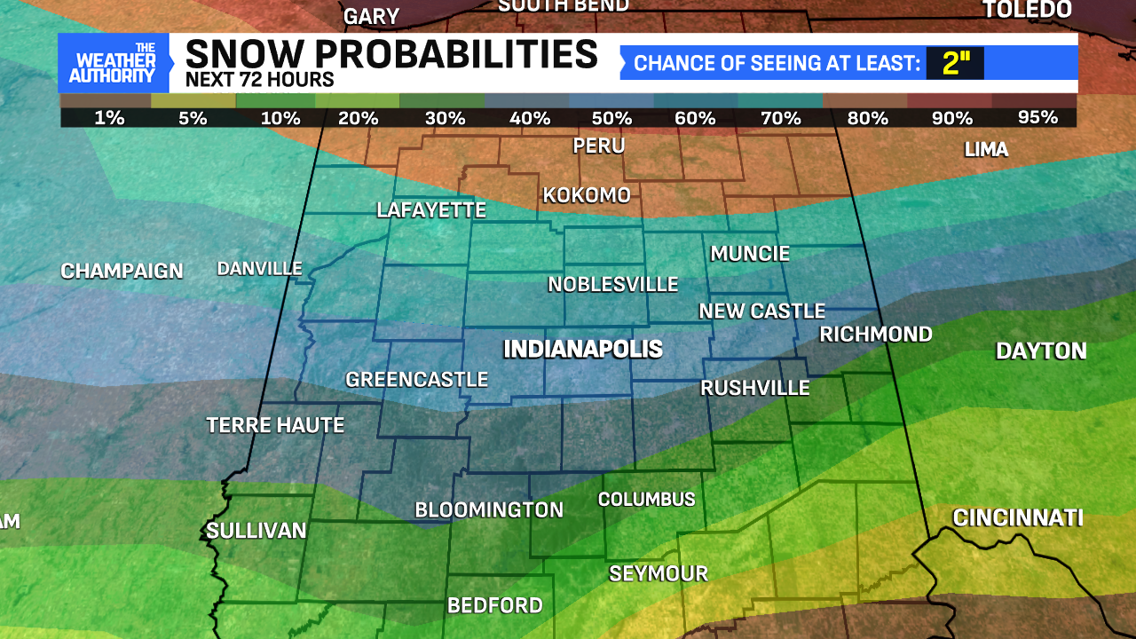
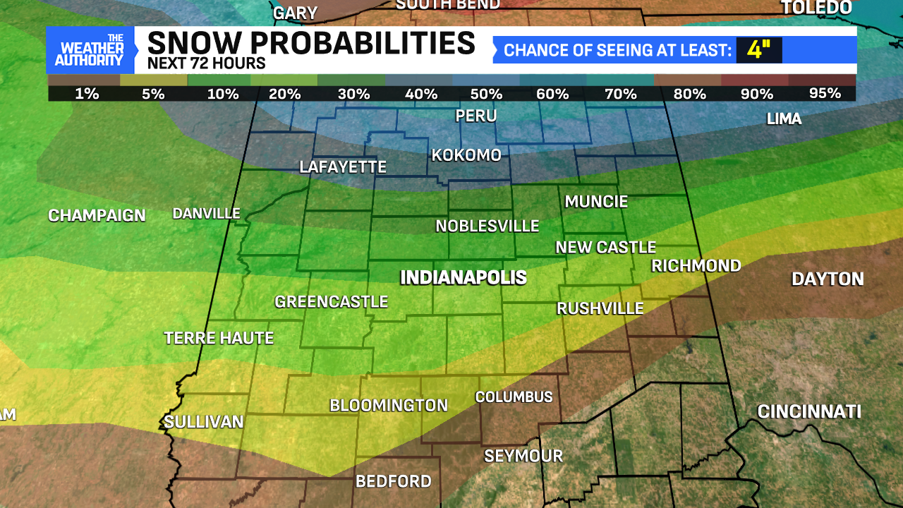
Round #2 moves in; additional snow accumulations possible
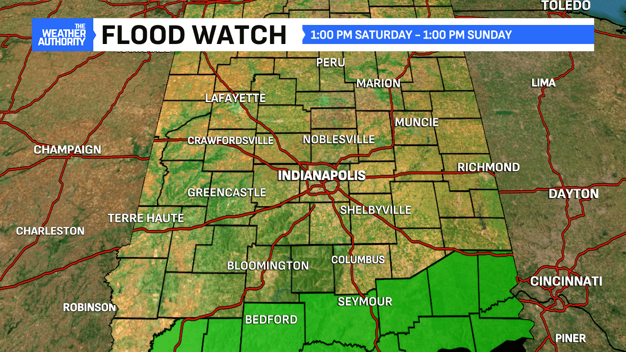
Ahead of this wave of precipitation, a Flood Watch has been issued for Southern Indiana because these spots have a higher rainfall potential with this wave. Starting around dinnertime, rain spreads north, with some spots potentially seeing around an inch of rainfall south of Indianapolis.


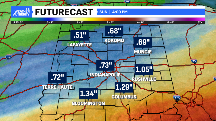
Once temperatures dip below freezing overnight Saturday into early Sunday, we anticipate a turnover to snow. The infusion of Arctic Air behind this system could give us a period of moderate-to-heavy snow before daybreak on Sunday. Speculation as to how quickly the change occurs could give totals near 4.0″ depending on the timing and track of the low.
This is still a work in progress, progress but plan on snow and Arctic air to finish the weekend.
Winter reloads next week, prolonged cold stretch likely
Once that Arctic Air moves in, the cold will be here and stick around beginning early next week. Highs in the upper teens to near 20° are likely each day starting Monday. Additionally, rounds of light snow showers are possible for the middle of the week. Lows during this time will be in the single digits, with subzero wind chills also returning.
Comments are closed.